
Sagalassos Ancient City: 24 Facts About a Taurus Gem


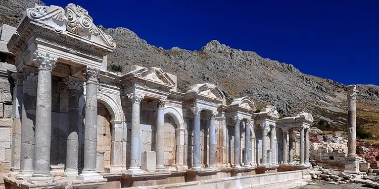
The Sagalassos ancient city stands high in the Taurus Mountains of southwest Türkiye, a Roman showpiece of pale stone that was found late and left remarkably intact. Its Anatolian name is older than Rome, and its story ranges from Luwian pottery makers to Alexander the Great, imperial festivals, plague and drought. Here are 24 things worth knowing before you climb up.
1. Climate and Geography: A City on a Terraced Slope

Sagalassos sits at roughly 1,700 m (about 5,600 ft) on a south-facing slope below Mount Akdağ (2,271 m). Residents terraced it for flat ground. Safety, plentiful water, good clay and iron deposits all explained the choice. Lying about 110 km north of Antalya and 7 km from the town of Ağlasun, in Burdur province, the city controlled the mountain passes between the Mediterranean coast and the Anatolian plateau. Then came 1706. French traveler Paul Lucas, moving with a caravan from Antalya to Konya, stumbled on the ruins that year and in effect rediscovered the city.
2. One of the Mediterranean’s Biggest Multidisciplinary Digs

Excavations led by Marc Waelkens of KU Leuven began in 1990, after an earlier survey. They now cover about 1,200 sq km around the city. Why so intact? A major earthquake in the 7th century AD buried much of the Roman city. The site is also high and remote. No modern town grew over it. Specialists in some 15 to 20 fields, with a team of roughly 180 people, have traced everything from climate and farming to ceramics, which makes Sagalassos one of the most closely studied Roman cities in the region.
3. Give the Site a Full Day

The city splits into an upper and a lower part. Highlights start with the Antonine Nymphaeum, a fountain that runs again today. Then come the agoras, some of the oldest Roman baths in Anatolia, the macellum (market building), the Heroon with its dancing girls, the colonnaded street, the library and an urban villa, all on the way to a theatre that seats 9,000 and is often called the world’s highest-altitude ancient theatre. A thorough visit with signs and photos takes a few hours. Plan two to four. Wear sturdy shoes; the city was built on a slope, and every staircase reminds you.
There is no public bus, so arrive by car, taxi or organized tour.
4. The Luwian Roots of the City’s Name

Nobody knows what the name means. It probably comes from the Luwians, an ancient Anatolian people related to the Hittites. According to Waelkens, the Luwians stayed in western and southern Anatolia while the Hittites settled in the center, and he links the Hittite place name Salamassa to Sagalassos, an idea supported by Bronze Age pottery finds. Pottery runs deep here. He notes it has been made on the Burdur plain for thousands of years. The Sagalassians themselves were Pisidians. Their city grew into the most important Roman city of the Pisidia and Lakes region, with a core population he estimates at 3,500 to 5,000 people and perhaps 15,000 including the farms around it.
5. Six Hundred Years Without a State

Pisidians lived in the mountain belt between Phrygia to the north and Lycia and Pamphylia to the south, in towns built at altitudes between 1,400 and 1,700 m above sea level. They were fiercely independent. No unified state, no ruler. Water, fertile land, natural defense and control of the passes made them rich, and this arrangement held for roughly 600 years—until Alexander the Great arrived.
6. The Pisidians Meet Alexander the Great

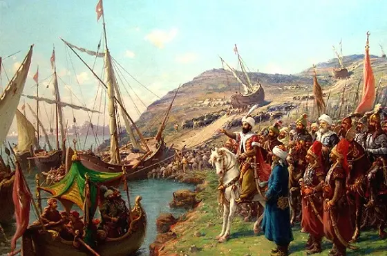
Pisidians clearly liked rugged terrain. Take Termessos. Its people built their city like an eagle’s nest in a steep valley at 1,040 m on Güllük Mountain, just north of Antalya, and it is the one city Alexander is said to have failed to take on his eastern campaign. Eagle’s nest or not, it sits some 650 m lower than Sagalassos. After stopping at Phaselis and then visiting Sillyon and Perge, Alexander passed Termessos on the way back and fought the Termessians at the gate on today’s Korkuteli road. The siege, he expected, would take six or seven months. He gave up. Not a sentence that turns up often in Alexander’s biography. Moving west instead, he arrived at Sagalassos in 333 BC.
7. Alexander’s Hill, Where the Battle Was Fought

Waelkens says Selge, the most important Pisidian city at the time, made terms with Alexander. Sagalassos and Termessos refused. Sagalassian soldiers were famous—some even worked as mercenaries in the Persian army, and the historian Arrian describes them as the bravest of a warlike people. A fierce battle took place on the hill south of the city, now called Alexander’s Hill, which was later used as a necropolis and then as the site of an early Byzantine church and a fortress. After the battle, Alexander took the other Pisidian cities and moved on. Sagalassos began its rise.
8. A Wonderland in Anatolia

Roman rule came in 133 BC. The real golden age, though, began only in the 1st century AD under Augustus and lasted into the 6th century, as the long Pax Romana, Augustus’ reforms and new roads tied Sagalassos to Rome’s trade network and the Mediterranean. A milder climate helped too. Analyses suggest olives grew up to 1,400 m back then, compared with about 900 m today, and wheat, corn and olive oil became export goods.
9. Sagalassos’ Famous Red-Slip Pottery
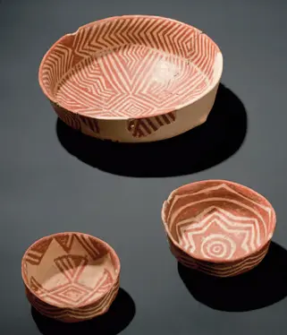
Local clay turned the city into a pottery powerhouse. Shipped from the Pamphylian ports, its red-slip tableware spread across much of the Mediterranean. It reached Carthage, too. One quarter of the city was known as the Potters’ District.
Under Hadrian, the city became a center of the imperial cult and took the title “first city of Pisidia,” entering a second golden age.
10. The World’s Highest Ancient Theatre

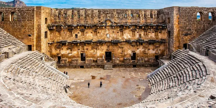
A theatre for 9,000 suggests a big city. Wrong guess. About 4,000 people lived here, yet they built seating for more than twice that, and it is widely described as the highest-altitude ancient theatre in the world. The size made sense, because Sagalassos hosted religious ceremonies and festivals at set times of year, and people from all over the region came to take part in them. The theatre served those crowds. Not the town’s own needs.
11. City of the Emperors, a Showcase of Roman Architecture

Fine beige limestone came from nearby quarries along the northern ridges, worked between the 1st century BC and the 3rd century AD. A strong economy helped. So did a steady flow of religious pilgrims, and by the 3rd century the city had filled up with grand buildings.
Temples, baths, tomb monuments and private urban palaces joined the theatre.
12. The Antonine Nymphaeum, the City’s Most Elegant Building

Rich Sagalassians preferred to show off their wealth with monumental fountains. Subtle it was not. These rose across the city. The Antonine Nymphaeum proves how grand the city was. Built under Marcus Aurelius (AD 161 to 180) and restored in 2010, it is made of stones in seven colors and Afyon marble that plays with light, measures 28 m long and 9 m high, and carries decoration with symbols of Dionysus.
13. The Heroon, a Monument Seen From Far Away
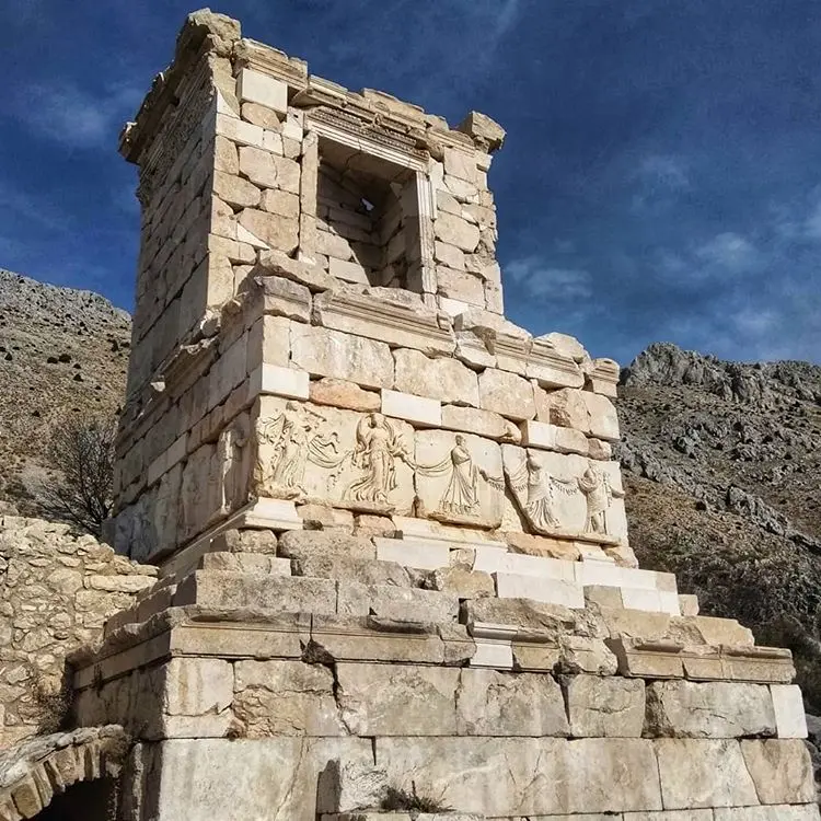
Another rebuilt landmark is the Heroon. This monumental tomb honoring a hero rises about 15 m, so it could be seen from a distance. Life-size dancing girls surround it.
14. Innovators in Technology, Architecture, Glass and Ceramics

Waelkens argues that Sagalassians differed from other Pisidians. New Roman techniques often appeared here first. Building, glass and ceramics all show it. The city tripled in size between about 25 BC and AD 14, and its council house for 220 people symbolized civic democracy. It did not last. Heavy taxes and rents, he explains, pushed many residents out, and eventually offices were bought with money. Put simply, only the rich could govern—which ended the democratic spirit of the place.
15. Roman Colonies in the Region

During the Pax Romana, Augustus founded six colonies in this fertile region. The numbers were large. Settlers came from Rome and southern France, estimated at around 50,000 people in all, and the largest colony of the six was Antioch of Pisidia, the town known today as Yalvaç.
16. Augustus Builds a Road

The emperor built a large road, the Via Sebaste, from Yalvaç to Perge. A letter of Tiberius explains why it mattered. Sagalassos reached the sea. Pottery that once served the region now reached the whole eastern Mediterranean, the city’s farming economy flourished through trade, and some wealthy families built large country estates on the plains. The big tombs out in the countryside are the proof.
17. Trade Brings Cultural Riches

Cedar, oak and pine from nearby forests floated all the way down the Kestros (Aksu) River to the Mediterranean, and Egypt, short of timber for its ships, bought a lot of it. Trade ran both ways. Egyptian gods, Waelkens notes, became popular in Sagalassos, and reliefs from Egypt turned up in the baths.
One fish bone is thin evidence, admittedly. Still, DNA analysis of it reportedly pointed to a Nile species—dried fish, it seems, arrived from Egypt for some 700 years.
18. Local Elites Paid for 60 Percent of the City
Around 60 percent of the buildings, according to Waelkens, were funded privately by the city’s rich families. Rome granted citizenship to some. A generation later, a few Sagalassians sat in the Roman senate and paid for building at home. In the 1st century BC, buildings were typically dedicated to the emperor as a show of loyalty, a system that began to change soon after, in the age of Hadrian.
19. The Imperial Cult and the City’s Peak

Under Hadrian, Lycia, Pamphylia and Pisidia needed a center for the imperial cult. Sagalassos was chosen. Every year, visitors from across western Anatolia came for the imperial festivals and games, and because they spent heavily during their stay, each season added to the city’s wealth. Hadrian honored it as the most important city of Pisidia. Coins, inscriptions and a decree recorded the claim.
20. Fountains That Make Water the Star

The theatre could seat twice the city’s population. The baths grew until they matched those of Ephesus, and the odeon served as a large covered theatre. Sagalassos apparently entertained steady streams of visitors, with buildings planned for even bigger crowds. The rich also funded public fountains. In the 2nd century AD a new type appeared: the nymphaeum, with a big pool in front and statues of donors and their families standing beside the emperor and gods in niches between columns. Waelkens reads it as devotion.
21. “Nothing Like This Water in Europe”

The local geology of permeable limestone over clay beds filters rain and snowmelt into water with a distinct taste. Four monumental fountains were built in the imperial period. One flows again. Waelkens’ team tracked down its original water source, then reassembled nearly 3,000 stones into about 400 building blocks to restore the Antonine Nymphaeum in the upper agora, so that it runs once more. The water, Waelkens says, is very clean and cold, and tests in Belgium found nothing of that quality even in Switzerland.
He calls it perhaps the best spring water in Türkiye.
22. Earthquakes and Plague Prepare the Ending

Sagalassos stayed rich until the end of the 2nd century AD and rode out a small crisis in the 3rd. The next one was different. A long crisis, from the later 4th century to about 525, hit it hard. Temples were converted into churches, and after an earthquake around 500 the city rebuilt with care. By the mid-5th century the city was already turning into a large farming village. Waelkens blames disease. The plague that arrived from Egypt in 541 to 542 killed, by research he cites, about 32 percent of Anatolia’s population, wiping out rich families and leaving landowners to farm for themselves.
A fault runs through Sagalassos, and a terrible earthquake centered there between about 602 and 620 killed most of the remaining population.
23. Climate Change Ends Farming

Earthquakes alone did not do it, whatever the rubble suggests. Around 250 pottery kilns supplied export markets, and 82 of them have been excavated. They needed fuel. Cutting trees for the kilns, and clearing land for big estates, damaged the forests. Pollen analysis, Waelkens says, shows people replanted trees, but around AD 650 the climate turned colder and drier and a severe drought ended farming. Small villages grew around the city in the 7th century, shifting from crops to herding, and they lasted until Seljuk times, after which the settlement moved down to where Ağlasun stands today.
24. From Sagalassos to Ağlasun

Sagalassos and Ağlasun are two pronunciations of the same name; say both out loud and the link is hard to miss. Plenty of visitors drive through Ağlasun on the way up without noticing that the town carries the old city’s name. The shift is old. An early 11th-century record already calls the bishop the “Bishop of Agalassu.” When the Seljuks took the region in the 13th century, people living among the ruins and in nearby villages were resettled 7 km below, in the plain, in what became Ağlasun.
Sources: Archaeology Magazine: Sagalassos, Turkey Travel Planner: Sagalassos, Ministry of Culture and Tourism museum portal

Bir yanıt yazın